Out of Virginia

It only took six months, but I’ve finally escaped Virginia.

Crossing the Appalachian Trail border into Tennessee, about 3.5 miles south of Damascus (Va.), was a long-coming revelation.

After months in Virginia, this was a welcome sign.

Don’t get me wrong. Virginia is a beautiful state. It has the Shenandoahs and the Blue Ridge mountains. It has charming towns and wonderful people.

But for some reason that I have not yet deciphered, Virginia seems to be my Kryptonite.

When I rode my bicycle from coast to coast in 2021, it was the punishing hills of southwestern Virginia that forced me to shorten my daily miles and reconfigure my plan.

Then in fall 2022, as I hiked the Appalachian Trail south, having completed 1400 miles from Maine, I crossed the border into Virginia on September 27, 2022, and immediately contracted Covid after spending the night in a crowded bunkroom. Six days later, I limped out of my convalescent hotel room and hit the trail again, eager to ramp up miles. Too eager.

One week later, my right foot screamed with pain every time I put weight on it. Stress fracture, I later learned. So I left the trail, back home for the winter and healing.

The famous McAfee Knob, a Virginia highlight.

I returned to Virginia on March 18, 2023, to the exact spot where I limped off the trail five months earlier: Jennings Creek, about 30 miles north of Daleville. I anticipated resuming my AT hike all winter, but the first few days were rough. Freezing nights and mornings. Aching feet from a bad pair of custom orthotics I’d purchased to protect from getting another stress fracture. And, because I wasn’t back in trail shape yet, the hills (always the hills) were killer.

About three weeks of this, I started to regain my trail shape. Then, one fine morning coming out of Marion, Va., I developed an excruciating shin splint in my left leg. Three more days off, hanging out in Damascus. Tennessee beckoned only a few miles away, but I wondered if I would ever be allowed to leave this state.

New State, New Attitude

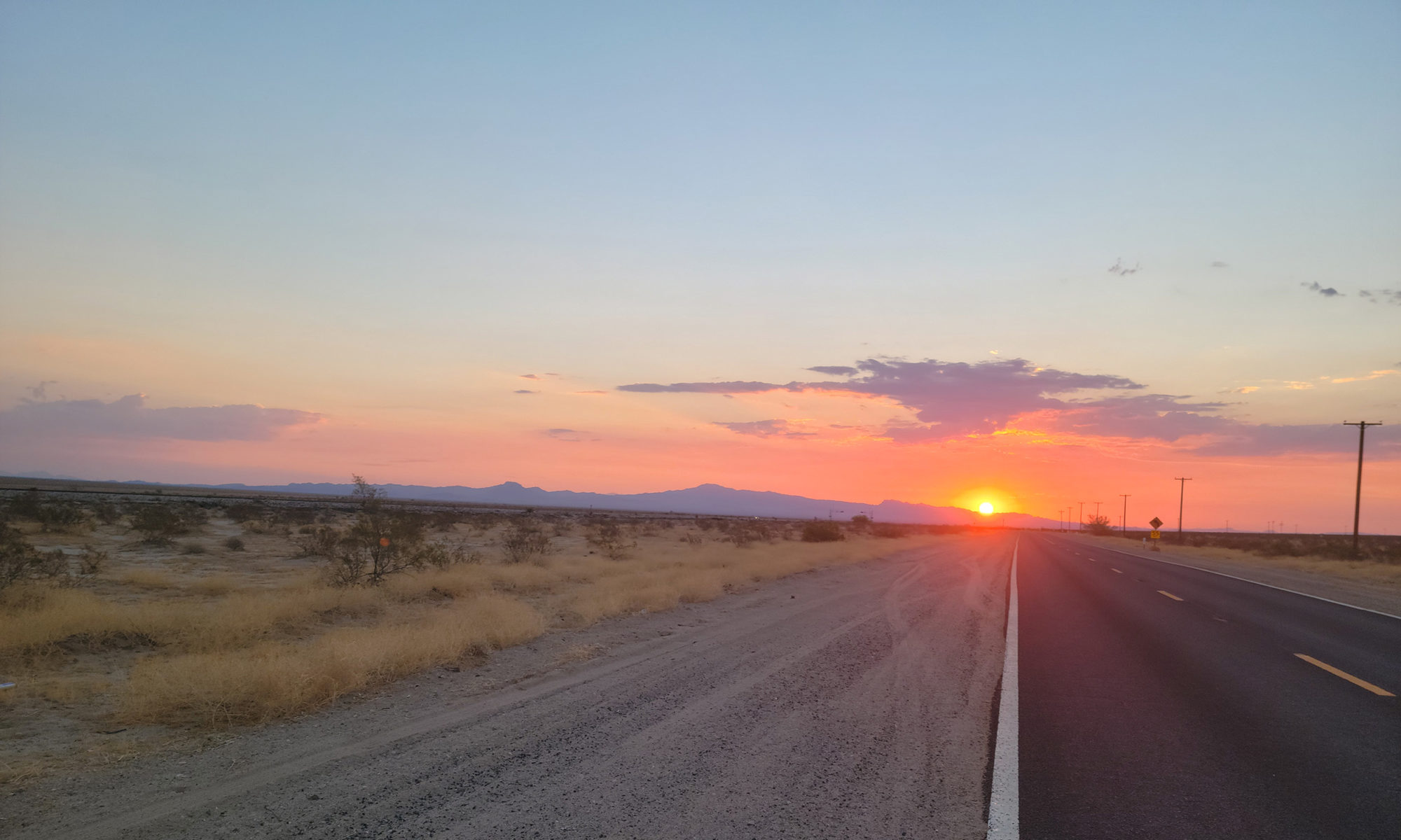
Finally, on Sunday, April 13, with new shoes, compression socks, a bottle of Ibuprofin and Arnica, I left Damascus and climbed up to the Tennessee border.

It seems far-fetched, but the minute I crossed the border out of Virginia, things changed. My attitude, for one. But also the trail changed, from a green, rocky tunnel through endless Rhododendrons to an open dirt path atop remote ridges overlooking layers of mountain peaks to the horizon. Even the trees suddenly had more leaf buds.

Then there’s my health. The shin splint has continued to improve thanks to Tennessee. I have little doubt that if I were still in Virginia, my shin would have hobbled me by now and probably spread to the other leg.

Finally, your perspective changes in Tennessee when hiking south. You’ve survived a lot by this point, including the fabled Virginia Blues. Now you’re in a new state, one that only takes about a week to get through. And once you do make your way through Tennessee, you only have two states left to complete the journey: North Carolina and Georgia, where Springer Mountain brings you to the southern AT terminus.

Many reasons to celebrate Tennessee.

Virginia Blues

I’m not the only AT thru-hiker to lament Virginia. The state is famous for its mid-hike doldrums. You walk and walk, day after day and the scenery rarely changes.

Or maybe it’s just that Virginia is the longest state on the AT, stretching 556 miles from north to south, nearly twice as long as any other state. We hikers hunger for progress, for variety and landmarks that let us know we are getting somewhere for all our effort. But Virginia just slogs along, week after week, for typically more than a month.

Or, for me, more than six months. I mean, not literally, since I spent the winter at home in western Massachusetts. But mentally, I never really left Virginia. All winter, my thoughts remained stuck to that rural road crossing at Jennings Creek where my cracked toe disallowed further progress.

Kelly and Linda Mulheren, trail angels extraordinaire.

I traveled back to Daleville and had a hard time escaping that town. The whole state has been one setback after another.

Yet, for all that, I love Virginia. I met wonderful trail angels Linda and Kelly Mulheren there. And I have many amazing Virginia memories.

Still, six months is enough time to spend mentally strapped to that state.

It was high time to have moved on. I’m happy to be in Tennessee.

Midday Escape from Daleville

It was broad daylight. Around 11 a.m. I’d been trapped in Daleville for nearly two days. Holed up inside a kind of fortress that brazenly displayed a neon sign out front: “Super 8,” its bright yellow light screamed through the night.

I knew I had to get out, by any means necessary.

Daleville the town is harmless enough. A small burg in western central Virginia that specializes in strip malls, Cracker Barrell and unwalkable roads. Even the Super 8 served a purpose on my journey. Once. Twice. Now a third time.

I’d already spent a week at the Daleville Super 8 in late October 2022. It was the refuge I turned to when I hobbled off the Appalachian Trail with a stress fracture in my right foot, third metatarsal. The Super 8 was where I made the excruciating decision not to continue, to call a hiatus from the trail, return home and nurse my injury for the winter. It was from where I limped out every night back then, across the parking lot and up to the bar at Pancho’s, a Mexican restaurant, the only eating establishment within walking distance.

Super 8 of Daleville was where I returned once again on March 17, 2023. A place from which to launch my resumption of an AT thru-hike. Fly into Roanoke-Blacksburg Regional Airport and the Daleville Super 8 is an easy enough Lyft ride away. I arranged a shuttle pickup to run me up to Jennings Creek, about 30 miles north, where I last exited the AT.

Two and a half days of hiking brought me right back to Daleville, to an annoying highway crossing two doors down from the Super 8. Back again. And again, the Super 8 offered the value of a room with Wifi to facilitate my writing deadline. For this third stay, having regained the benefit of my healthy foot, I could venture further from the Super 8, into Daleville proper. There I visited a series of establishments. Kroger’s, for trail resupply. Mountain Trail Outfitters for some sunscreen. And most importantly, Three Lil Pigs BBQ for sustenance, a much-needed change of pace from overused Pancho’s.

Three multi-night stays in Daleville. Three respites at the Super 8.

I knew I had to escape.

Breakout of the Super 8

High in the mountains above Daleville, Va., near Hay Rock.

It wasn’t an easy caper. I packed up in silence, hoping not to attract any suspicion. I pulled on my pack and surreptitiously descended the stairs to the lobby.

Melissa at the front desk appeared to know exactly what I was up to, and asked if I wanted a receipt. Surprised at her penetrating foresight, I stammered, unsure what to say. Finally, I whispered, “Can you email it?” She could, no problem.

She wished me well with all the transparency of a KGB thug. Behind her smile I suspected chicanery. She betrayed her motive and proved my suspicion correct when she welcomed me to “come back again any time” loudly enough for others to hear. “We love our regulars.”

So that was how it was. A Daleville Super 8 regular.

It was decided then. Escape I must, and quickly.

I smiled, too, playing Melissa’s game. Then I stepped out through the automatic sliding door. And I was outside. Ready to leave, it seemed. But surely this was too simple. I tried not to look back but relented to my curiosity. Back inside the lobby doors, Melissa watched me, the smile still on her face. I knew it. I would never be allowed to effortlessly walk away from Daleville and the Super 8 forever.

But for the moment, walk I did, continuing on my way. Past Pancho’s. Across the obnoxious, unwalkable highway (after waiting eight minutes for a break in traffic). I could feel Melissa’s prying eyes still upon me as I walked back onto the AT.

Was it true? Had I escaped Daleville?

Gone But Not Escaped

But of course, it was all a ruse. Even as I lost sight of the Super 8 for the moment, I could hear that incessant Daleville traffic. Would it ever cease its torment?

After more than two miles hiking, Daleville Super 8 remains in view.

I hiked for a full hour, climbing up, away, hope building with every step, every foot of elevation gained. I crested a mountaintop adorned with massive, humming power lines.

That’s when I fell to my knees in agony. Of course it was all too good to be true. I would never escape Daleville. For far below, even after hiking for two hours, lay an unobscured view of the town, splayed in all its mundane paleness. And directly across from me, glaring in a clearing, its neon sign reaching out to me miles away, pulling me back: the Super 8.

I hadn’t escaped anything. I hastened onward, still determined to leave Daleville behind for good. Another hour, another several miles along a mountain ridge. Still, relentlessly as I stopped for breath, the traffic and sounds of Daleville and that loud yellow sign yelling Super 8 reaching up to me in the hills.

I was convinced. I could hike all day, for days on end even, and still not escape this bland, nondescript town and the Super 8 that once offered succor.

If you squint, you can still see Daleville Super 8’s yellow sign far in the distance.

Even now, alone in the woods, night setting in, while I can no longer see Daleville below, nor hear its car horns honking, its truck engines whining, while the Super 8 sign doesn’t light up the forest, I know. It’s still there. Never far away. Beckoning me back. It will always be there. When I close my eyes. When in the silence I hear its echoes. Whenever I dine out on mediocre Mexican food.

I’ve left Daleville, but I haven’t really escaped. I will go back again someday.

I am, after all, as Melissa made all too clear, a regular at the Super 8.   

Back on the (Cold) Trail

Sleeping bag liner? Nah, shouldn’t need it.

Insulated gloves? No way, overkill.

Base layer? Don’t want to carry the weight.

My first night back on the Appalachian Trail, March 18, it became apparent I had erred. I hiked 10 miles from a rural trailhead at Jennings Creek, about 30 miles north of Roanoke, Va. The hiking was awesome all day, around mid-40s and sunny. I stopped at a shelter named Bobblet’s Gap and humped a quarter-mile down switchbacks to the structure. It was around 5 p.m. when I arrived and the temperature was dropping fast. It wouldn’t have been too bad except for the icy wind, which picked up intensity through the night.

I bundled up, confident in my 20-degree sleeping bag’s ability to withstand the cold assault. I’d slept in cold weather before.

But not like this. Not with this freezing wind buffeting my thin layer of nylon. Not exposed on the slatted wood floor of a three-walled shelter with nothing holding off the wind. And not without having prepared for freezing weather with base layer, sleeping bag liner and, sometimes, insulated gloves.

At around midnight, I was remembering my errant rejections of those cold-weather supplies as the temperature dropped below 20 and seeped into my sleeping bag. My double-socked feet were the first to let me know this would be a fitful night as I struggled fruitlessly to get them warm and comfortable. Then I felt the frigid draft on my back every time I turned on one side as it snuck in the open top of my sleeping bag and wheedled down lower and lower like a snake seeking warmth. Eventually, the shivering began. I restrained myself from checking my watch every few minutes to see if this interminable night was working its way toward morning sun.

It wasn’t.

Move or Stay?

I considered getting up, packing my things in the midnight dark and start hiking again. It probably would have been the prudent thing to do. And if it were any colder and if I were not able to snag a few moments of sleep here and there I would have opted for that dire choice.

Instead, I hunkered tighter from the cold, curling into an ever tighter fetal ball and waited it out. Morning would come. Eventually.

Welcome back to the Appalachian Trail.

Smart Packing

Packing for a backpacking trip is an art in itself. It’s a fine balance between stripping down your list to the barest of essentials and anticipating must-haves and levels of comfort.

Some thru-hikers prance down the trail with a pack weighing only 12 or 15 pounds, equipped only with a plastic tarp for shelter, no changes of clothes and a handful of energy bars. I admire them but it’s not for me. I’m not the heaviest of packers, but I insist on an enclosed shelter like a tent of hammock, a sleeping bag and things like rain gear, eyeglasses and actual meals.

But when I’d set the date for my return to the AT, I checked weather forecasts for the central Virginia region I’d be returning to, and they looked reasonable. Lows in the 30s, highs in the 50s. Sounded quite ideal for hiking.

My main error was not considering the elevation. A rookie mistake that I’ve sufficiently berated myself for. My shelter mate that night, trail named Cayenne, told me about a site named ATweather.org. Plug in the shelter you’re aiming for and it’ll give you the weather forecast at that location, rather than, uselessly, down in the towns 3,000 feet below.

That would have been good to have when I was packing. I might have thrown in my sleeping bag liner. Definitely would have packed my base layer. That surely would have yielded me a better night’s sleep.

Tough Morning

As long and uncomfortable as the night at Bobblet’s Gap was, the morning was even more intense.

Cayenne, a hardy Vermonter, rose at 5 a.m., well before daylight, and headed out into the dark. He’d been hiking since January and was equipped for the cold.

That left me alone in the shelter, deep down in the gap where, even as the sun rose above, its rays would not penetrate into this gully.

Sunset at Fullhardt Knob.

The most mundane of morning chores were a quick dash out and back into the sleeping bag to warm frozen hands. Brushing teeth. Retrieving water. Making breakfast. Each time, back inside the sleeping bag to recover. I was dreading the moment when I’d have to pack up the sleeping bag, my only source of refuge.

To make matters worse, all my water had frozen. No morning tea. And I’m a cold-soaker, meaning I don’t carry a stove to heat up water for meals. Eating my cold-soaked oatmeal was like chomping ice.

MacGuyver Time

Okay, I was caught off guard on my return to the trail. Made rookie mistakes. I certainly should have put a bottle or two of water inside my sleeping bag. That would have saved me from dehydration in the morning.

By the time I departed and climbed back up out of Bobblet’s Gap and the AT, it was mid-morning. At least I was moving, and my hands would thaw before long.

I climbed and built heat, the sun warmed the trail and gradually my layers came off. A pleasant hiking day ensued, for 13.5 miles, to a mountaintop shelter named Fullhardt Knob.

I took a sunset picture and checked the forecast, properly this time, on ATweather.org. Another frigid night, down in the low 20s.

I placed two water bottles inside my sleeping bag, along with my gloves. A childhood fan of the TV show MacGuyver (the old one, haven’t seen the new one), I considered everything at my disposal. I stuffed my tent rain fly inside my sleeping bag to simulate a liner. I zipped myself up inside my tent. I put on every layer of clothing I had, including rain gear. And though my sleeping bag zipper chose to stop working and wouldn’t close up at about midnight, I adjusted and slept restfully for nearly nine hours.

The forecast for the coming week looks perfect with highs in the 60s and lows in the 30s and 40s. I survived the freeze.

Welcome back to the trail.

Rock Star on the Trail

My daughter Livvy is a rock star hiker.

I already knew this. But it was reiterated for me recently when I hiked through New Hampshire’s White Mountains as part of my Appalachian Trail thru-hike.

Livvy Weld finishes the Pacific Crest Trail

Livvy’s recent completion of the Pacific Crest Trail, a 2,600+-mile challenging hike from the Mexican border in California to the Canadian border in Washington, would be enough to qualify her rock star credentials. But she had already locked it up four years ago when she took her spring semester off from college to solo thru-hike the AT, at age 19.

I humbly follow in her footsteps. Except, where she hiked the AT from Georgia to Maine, I am hiking the grandfather of all trails from north to south, having started with a summit of Maine’s Mount Katahdin on June 30.

As I climbed among New Hampshire’s 4,000-foot mountains on a daily basis, I made a point of stopping in to visit each of the Appalachian Mountain Club huts dotting the trail throughout the grueling White Mountains.

Further bolstering her rock star credentials, Livvy has worked as a member of AMC hut crews (hut “croos” in the vernacular) for several years, in Zealand Falls Hut, and as hut master at Mizpah Hut. She recently started as hut master at the famous Lakes of the Clouds Hut, perched just below the summit of Mount Washington, for the fall 2022 season.

Celebrity Status

As I stopped into each hut during my White Mountain hike, I made a point of approaching the croo members. It went something like this:

“Do you know Livvy Weld?”

“Yes! We know Livvy! Oh my god, we love Livvy, she’s awesome, Why?” This interchange took place every time, without fail.

Then, my favorite part: “I’m Livvy’s dad.”

“You’re kidding! Oh my god, Livvy’s dad is here, what are the odds? Come in, have some free food, can I get you anything?”

Word Travels

Being treated as a celebrity because of my offspring was a highlight of my AT so far and defines New Hampshire in my memory.

I stopped by Carter Notch Hut amid a torrential downpour and met Bailey, Cooper and Caro. Caro even knew my name:

“I’m Livvy’s dad.”

“Oh my god, are you Eric?” Caro asked right away. (Livvy didn’t remember mentioning my first name to her croo mates.)

Livvy and me in the Mojave just before she departed on the PCT.

I next went to Madison Hut and met Riley, Noah and Will. They offered to let me work-for-stay, an option for thru-hikers in which they can help the croo with kitchen and dining duties in exchange for staying in the hut (sleeping on the dining room floor) and eating left over dinner once paying guests have finished.

I stopped by Lakes of Clouds Hut and met Acadia, who was Livvy’s assistant hut master last year, and Aidan and Lydia. Then over to Mizpah and met CC, who went to Smith College with Livvy.

By the time I worked my way to Lonesome Lake Hut and met Jo, she knew I was coming.   

“Hi Jo, I’m Livvy’s dad, I’m thru-hiking the AT while she’s thru-hiking the PCT,” I said.

“I know,” Jo exclaimed, to my surprise. “Word came through that Livvy’s dad was coming through the huts, and I so wanted to be here when you came by.” Jo offered me left over breakfast and a wonderful savory scone before I pushed on to climb the Kinsmans.

Opposite Directions

Since learning (over again) that my daughter is indeed a rock star on the trail (and that word travels impressively fast among croo members), I have proceeded to send many northbound thru-hikers her way. “Say hi to Livvy when you pass through Lakes of the Clouds.”

I wished my and Livvy’s trail timing could have worked out more in sync so that I could have seen her at work in her hut as I hiked through. As it was, we both appreciated the symbiosis of thru-hiking simultaneously, albeit her north near the west coast as I traveled south near the east.

But my experience meeting her croo mates and friends throughout the Whites provided the effect of helping me feel closer to my daughter as we co-thru-hiked our respective journeys. And, of course, it underscored for me, once again, that my daughter is truly a rock star.

Shifting Credibility as a SOBO AT Thru-hiker

As an Appalachian Trail thru-hiker, once you’ve trekked southbound through Maine’s gnarly trails and into New Hampshire’s White Mountains, attitudes and perspectives change dramatically.

You gain a new kind of street (or, in this case, trail) cred. Fellow thru-hikers look at you differently, talk to you with a heightened respect and seek your knowledge in a way they never would have when you were a newbie back in central Maine.

View of Mount Washington in the clouds, from summit of Mount Pierce.

In those nascent days of first stepping into the 100-mile wilderness, the few northern-bound thru-hikers (NOBOs) floated by like battle-worn soldiers, having survived the Whites and the maddening, rocky, rooty climbs of southern Maine – not to mention 1,700 previous miles of AT. You nearly genuflected to their experience and superior knowledge, like a rookie thirsting for nuggets of wisdom.

I was talking about this with my hiking friend Grills on a recent descent down from the Franconia Ridge. Grills completed thru-hikes of the Pacific Crest Trail (PCT) and the Continental Divide Trail (CDT) and has hiked the Colorado Trail, the Arizona Trail and other rites of passage. His successful completion of an AT thru-hike will net him the vaunted Triple Crown, a rare accomplishment of having thru-hiked the AT, PCT and CDT. These people are regarded like hiking gods on the trail.

“It’s like everything changes once you get into the Whites as a SOBO,” Grills said. “Like all of a sudden you got respect.”

I had to agree, and said so. “I’ve noticed,” I said. “Now, NOBOs ask me for advice about the trail coming up and listen to what I have to say. It wasn’t like that in Maine.”

100-Mile Test

There’s no name for this phenomenon that I know of. It’s just a shift, a subtle accumulation of worldliness by virtue of having gone through something difficult and survived to continue on.

This is an earned respect, to be sure. Hiking the AT south through Maine is, by popular consent, a trial by fire, a grueling 280-mile test of will in which your body and mind will be pushed to their limits of ability, resourcefulness, patience and endurance.

On my first day heading into the 100-mile wildnerness, back on July 1, I stopped by a convenience store at Abol Bridge, the northbound entrance to Baxter State Park, to chat with a few fellow hikers. One 19-year-old NOBO was giving us SOBO newbies an account of what lies ahead.

“The 100-mile wilderness is a test to make sure you can even survive out here,” he explained. “Then you make it through there, and you climb up White Cap Mountain, your first ‘real’ mountain. That’s a warm-up for what’s coming up in southern Maine. And that’s a warm-up for the Whites in New Hampshire. It just keeps getting harder and harder, man.”

With each word me and my fellow SOBOs slunk deeper, our chins lowering heavily to the ground, daunted by his admonition. What were we getting ourselves into?

Earned Respect

That young NOBOs words turned out to be punishingly precise, and rang in my head every time I pushed my body to take another steep step upward climbing through the mountains of southern Maine and New Hampshire’s Whites.

Now, on the other side of the White Mountains, about to walk across the Connecticut River from Hanover, New Hampshire, into Norwich, Vermont, I understand with a rearview lens what all the admonitions were about.

Main intersection, downtown Hanover, NH

Hiking the AT SOBO will require grit right up front before your body and mind realize the need for it. The way I see it in retrospect is that I went into a kind of shock in which my brain became hyper-focused on the task – i.e. making it through Maine, surviving the seemingly impossible climbs of the Whites.

Once you do – once you survive that rite of passage and come out on the other side, that is, here in Hanover, NH – you have earned a certain aura of hard-earned respect based on your experience. NOBOs have not yet gone through this grinder, though they have survived the long-term slog to get this far north on the trail.

But at this trail transition, from the straight-up climbs, rocks and roots of Maine and New Hampshire, to the relatively smoother, dirt and pine-needle trails with vastly milder inclines of Vermont, Massachusetts, Connecticut and New York, we SOBOs and our northern counterparts are clearly on more even ground. The mere whiff of superiority from those NOBOs of Maine doesn’t exist here. We are closer to brethren, mutually respecting what each other has achieved.

And we’re still here, continuing on.

Just Let Maine Have Its Way

Maine is going to win. Of that you can be sure.

Hiking the Appalachian Trail in Maine is a matter of submission. When and how long it takes are the only questions.

Summit of Katahdin: the beginning of a southbound AT thru-hike.

I began my thru-hike of the Appalachian Trail with a summit of magnificent Mount Katahdin on June 30. I opted to take the Knife Edge trail to the summit, where the northern terminus of the AT begins. The Hunt Trail down Katahdin is also the AT, and thus began my thru-hike all the way to Georgia.

Following the Katahdin summit, a southbound AT thru-hiker (known as a “sobo”) then heads south through Baxter Park to Abol Bridge, the south park entrance, and the official beginning of the 100-mile wilderness. This is a trail stretch known for its isolation, lack of towns or amenities, comforts and exit routes. It’s just wilderness.

What the 100-mile wilderness also offers are breathtaking vistas, countless water bodies, no limits on serenity, peace and nature.

Hiking in Maine

I began my thru-hike into the 100-mile wilderness with the arrogant thought that I’d done a lot of hiking over the years, pretty much knew what it was about and would be the controller of my hiking destiny. That worked for a couple days. I had outlined a hiking schedule in advance, knowing it would be a flexible plan.

If you look closely, you can see a trail under all those roots.

What I learned fairly quickly is: hiking in Maine isn’t like hiking in most other places. Hiking in Maine is rugged, gnarly and slow. The environs are spectacular, but Maine’s trails feature massive, boa constrictor-sized roots that snarl up to snag your ankles and trip you at every opportunity. And not just every once in a while; constantly, and bunched together relentlessly. And in the few areas where there are not roots, there are rocks. Not evenly sized rocks, but all different sizes, cluttering the trail haphazardly so you can never take two steps the same, you’re always varying your speed, step and pace.

It’s always either roots or rocks. And that’s the easy part of hiking in Maine. That’s before the mountain climbing starts, heading south. Then it becomes all of the above except now you’re ascending a steep (no switchbacks in Maine) slope for two thousand vertical feet.

Who’s in Charge?

After a few days of pushing along imagining that I would cruise through Maine according to my schedule, insisting that I was in charge of my own hike, I soon learned that that was not the case.

I wasn’t in charge. I’m not in charge. Maine is in charge.

Spectacular summit of Saddleback Mountain

As soon as I relented, slowed down and agreed that I was subject to Maine, not the other way around, I began to enjoy its trails more.

Maine sets the rules, not you as hiker. Maine tells you when you will be able to cruise along for a few miles, when you will get tired, and when you must go very slow.

The sooner you realize that on this state’s trails, the more you will enjoy the experience.

Just let Maine have its way.

Praise to Maine

I’m relieved I gave in to Maine and recognized its natural dominion over me. Thankful I genuflected early on to its obvious authority and relaxed into it.

Hammock camping next to Little Jo Mary Lake, a highlight of the 100-mile wilderness.

Now, as my unwritten pact states, I accept what Maine agrees to grant me. I appreciate the precious few moments when the hiking is smooth. I slow way down to a single mile an hour on numerous occasions, to get up tall, unforgiving mountains, to pick my way intentionally through the maze of tree roots and sharp rocks strewn across the path. I respect the dangers of being hasty and trying to move through this state too quickly. That’s a recipe for injury.

Maine has been one of the hardest places I’ve hiked. In a way, I look forward to working my way beyond this state. In other ways, I will miss it.

Anyway, it’s not like getting through Maine offers any great reward heading southbound on the AT. Next up: New Hampshire’s White Mountains.

That should be much easier.

What Have We Done Lately?

Getting Way Out There While Winter Hiking in the Whites

New Hampshire’s White Mountains are among the most formidable hiking proving grounds in the eastern United States. Renowned for its 48 4,000-foot peaks, the White Mountains present challenges for hikers at every level.

Winter hiking in the Whites presents its own special challenges, and until this past month I had never tried it. I drove up toward Twin Mountain, NH, from where I would set out, on December 27, curious about the experience. I had two days of solo hiking in front of me.

Summit of Mount Pierce, New Hampshire White Mountains
Mount Pierce summit

I chose to hike up Mount Pierce on the first day, with an option to loop over to Mount Jackson, two 4,000-foot peaks in the famous Presidential Range, of which Mount Washington is part. I harbor an aspiration to winter hike up Mount Washington at some point, and I’d read that Mt. Pierce was one of a few good warmups for that much larger, and more dangerous, undertaking. (I will be writing about that adventure when I succeed!)

More Challenge Needed

Starting from the Highland Visitors Center on Route 302, I headed up the Crawford Notch Trail. This is not a difficult trail as they go in the Whites. It climbs steadily for about 3.2 miles, not especially steep. This moderate climb attracted a good share of hikers that day, so that the snow was well tamped down and the footing reliable. It was a cloudy day so views from the top were nonexistent around mid-day. What the peak of Pierce did offer was a harsh, snappy wind and a bald top that deterred lingering for very long there.

I sought more. So from the summit of Pierce I proceeded on the Mizpah Trail. As fellow hikers returned, doubling back on the same trail down, I trudged forward into the back woods on a little used trail with the snow path barely broken. For more than two hours I pushed through deep snow not seeing anyone else. It was isolated, still and utterly beautiful, with a modicum of risk (if anything happened to me out here, no one was coming to help.)

Exactly what I was looking for. Silence, solitude, snow and a decent challenge. I came across Mizpah hut, a good-sized lodging hut open to hikers starting in late spring all the way into November. My daughter, Livvy, was hut master at Mizpah this past fall, so I stopped and snapped some pictures of the boarded-up building to share with her.

Mizpah Hut, White Mountains
Mizpah Hut

Then I proceeded onto Mt. Jackson, still not seeing anyone for hours. I was in heaven. As I climbed to the summit of Mount Jackson, the wind whipped up and the skies cleared to give me an extended, stupendous view of the Presidential Range and beyond. It was blustery and cold so I didn’t stay long. But in the wind the trail down was hard to locate and for a minute I searched, haunted by numerous stories of hikers getting disoriented in the Whites and stumbling off the trail and getting in trouble.

Mount Jackson summit

Finally I found the Jackson Bridge Trail, which slipped straight down through an iced over and very slick rock gap. Really? I thought as I perused the gap from above. I’m supposed to go down that? I took my time and made it, then trudged the three miles descent back to the Highland Center.

More Deep Snowing Hiking

The next day I decided I would bag a couple more 4,000-footers, toying with the idea of adding all 48 4,000-footers in the Whites to my adventure list. It’s a thing. I’ve climbed about a dozen of them so far. We’ll see.

For today it would be the Kinsmans, north and south, two peaks on the north side of Route 93, opposite Franconia Ridge, which I’ve already done (though not in winter, when it becomes a more formidable endeavor).

I started up the Lonesome Lake Trail, another well-trodden path with no shortage of fellow hikers. About a half-mile up, I spotted an interesting but difficult-looking trail jutting straight up. I checked my map: the Dodge Cutoff, which led to the Kinsman Ridge Trail. I knew nothing about these, but it was off the beaten path so I took it.

A brilliant view of Franconia Ridge from Kinsman Ridge Trail

It was all I could handle. The Dodge Cutoff climbed straight up (no switchbacks in the Whites) and it wasn’t well-traveled so I was pushing through deep snow. I opted to continue climbing to Kinsman Ridge Trail, a gorgeous back country trail that cuts through the alpine at around 3,700 feet, just below Cannon Mountain.

I wanted isolated wilderness and I got it on this trail. It took me nearly three hours –no other hikers around – of steep ups and downs to work my way back to the more populated Lonesome Lake Trail. By then it was after 2 p.m.

More Adventures in the Whites

I opted to bail on the Kinsmans for the day. It would have been another two miles of climbing. I was zonked from the outback rugged trail I’d taken, plus the deep snow. Also, I would have run out of daylight, and though I had a headlamp, I didn’t want to be hiking down in the dark. I also had a three-hour drive back home when I was done.

The down via the Lonesome Lake Trail was steep and fast. I made it back to my car before 4 p.m. Almost six hours of steady hiking. I was ready to head home.

The beautiful thing about the Whites is that the park is so vast and there are so many trails that a hiker can get whatever they are looking for. A communal nature experience. A range of exertion levels, from moderate to difficult to intense. Or, pure isolation, in which some of the trails lead you deep into the wilderness where few others tend to go.  

That’s what I was seeking for this adventure. That’s what I got.

Many more White Mountain trails to explore.

Why Biking in the Dark Offers Rewards Over Daytime Riding

It’s late November, a cool time of the year. Temperatures chilling, air drying, leaves nearly all fallen, holidays on the horizon. Snow usually has not yet shown itself yet at this time of year.

In other words, late November is the perfect time for outdoor activities like hiking and biking.

The only problem is, there’s not much daylight. Once we set those clocks back to accommodate our weird and futile ritual of Daylight Savings Time, we only get about nine hours of natural light within the 24-hour cycle. For us working folks, that’s about enough time to prepare to go to the office in the morning and spend the day there.

By the time we’re heading home, it’s nearly dusk. If we do want to bike or hike, our only option is to do so in the dark.

Light Up

For a couple of reasons, pastimes like hiking and biking are not typically done in the dark.

For one thing, there’s the safety issue. Biking at night requires some precautions – at least a raised visibility and bright lights – that daytime riding can skip. And in order to hike at night, you should probably be familiar with or knowledgeable of the trail so you don’t wander unknowingly and dangerously near a precipice.

But safety issues can be overcome with good headlamps and bike headlights, with backup batteries and lights.

Nighttime activities can be a little spooky for some people. You simply can’t see as much, and that unknown factor alone raises the hairs on some people’s necks. The woods have a different feel at night, different animals scurrying about, different sounds and feel.

And cycling solo at night can be eerie. No kids at the dimly lit playground…creepy. Not as many people walking about, and very few other bikers on bike paths. For some that’s a positive. Others are spooked by it.

Into the Desert Night

I hadn’t taken a real bike ride at night until recently. When riding my bike across the United States in May-June-July 2021, I faced a 111-mile crossing of the Mojave desert. It had to be done in one day because there’s nothing out there, and the early July forecast projected 107 degrees. Not a place I wanted to camp.

My heat-avoidance strategy was to take off riding into the desert at 2 a.m. in relatively cooler temps. It was 90 degrees when I departed from Parker, Ariz., into the Mojave. And very dark.

Mojave desert sunrise
After three hours of dark riding, the sun peeked up in the distance behind me.

I had been nervous about the ride, especially riding alone into the desert at night. I had my superb headlight illuminating the road, two blinking taillights, reflectors on my rear-facing panniers and a highly reflective jersey. I was visible to the rare trucks ambling by on the road, I could tell by the way they backed off the gas several hundred yards behind me, signaling that I had entered their field of vision. No doubt I appeared as a strange apparition in the desert night, not something they expected to see. But it worked.

What I discovered in those few hours riding through the pitch black Mojave before the sun peeked up over the eastern hills in my rear distance, is that riding at night is a wonderful experience.

The feeling is so distinct from daytime riding that it’s like a whole different sport. The air is cooler, of course, but also stiller and more serene. The night is calm and peaceful in a way that the bustle of day can’t offer.

If I were to do that night ride across the Mojave again (which I probably won’t, for several reasons not including the enjoyable night ride), I would likely take off earlier, like midnight, in order to extend the pleasant night ride.

A Whole Different View

Ever since my night in the desert, I’ve been much more open to riding in the dark.

Recently I took another night ride. Here in November, it’s a wholly different sensation than a steamy summer desert ride. But it’s still serene and peaceful. Everything takes on a different visage in the low light. You see your hometown in a completely distinct way.

Of course, it’s colder at night, and in the Northeast in November it can be in the 20s or 30s. So extra layers, head coverings and gloves are a necessity for a pleasant experience.

I also wear my eyeglasses at night instead of sunglasses. They allow me to see more clearly and provide some eye shield from the cold wind.

It can take a mile or so to warm up. But once you do, the cool night air offers a refreshing balance to your body heat. The quiet and stillness envelops you and the lack of long views can create a sensation of floating. In remote areas the only thing you can see is the beam of light in front of you created by your headlight.

That’s where you’re going. Everything else is shrouded in a blanket of black. Except for the sky.

If you’re fortunate enough to be a in a rural area riding at night, be sure to look up. It may be cloudy and somewhat obscured. But if it’s a clear night, you are treated to a dazzling display of the billions of stars and planets that are always out there but only visible to us during night hours.

Into the Night

I encourage anyone with a bike to venture out in the night. It could be early evening, midnight or pre-dawn. You’ll get a perspective you haven’t had before, and it’ll likely surprise you. You might see people and sights you’d never see in the daytime.

No matter what, you will definitely get a fresh perspective.

It’s short-term adventure at its finest. Some challenge, a little risk, a new way of seeing things.

Take a ride. Into the dark.

Why Some of Us Venture Into the Unknown

The unknown is an important aspect of adventure. Taking on the unknown, braving the unknown, learning new things about the world, about yourself and other people, that you didn’t know before.

I recently ventured into the unknown in the form of a hiking trail I’d never been on before: the Taconic Crest Trail (TCT), which skirts the border between New York and Massachusetts at the south end, and Vermont toward the north. I opted toward the southern end in Petersburg, N.Y., just over the border from Williamstown, Mass.

Venturing into the unknown can be scary because…well, you don’t know what can happen, what lies ahead, what might await you. On the other hand, it can be exciting for the same reasons.

Crossing a stream on the Class of 33 Trail, an offshoot from the Taconic Crest Trail.

As survivalists, not so far removed from our hunter-gatherer forbears, our human minds jump to self-preservation when entering unknown circumstances. We anticipate the dangers ahead, the forces that might threaten our survival. Animals that may want to harm us for their own or their offspring’s self-preservation, or perhaps a meal. Slippery slopes and cliffsides that could hasten a fatal fall. Strange plants and roads and people and shapes all converging into a spooky, forbidding landscape ahead.

For some, it’s enough to deter going forth into the unknown at all.

For me, it’s always a wonderful opportunity, to see and experience new territory, smell new smells, discover angles of the sun streaming through forest that you haven’t exactly witnessed before.

Heading into unknown territory, I remain aware of the potential hazards. But as an optimist, I also anticipate the upside, the possibility of amazing new sensations, fresh perspectives and different ways of seeing the world. I welcome the ways in which the unknown experience ahead might change me by broadening my purview.

Slip-sliding Away

The Taconic Crest Trail isn’t a particularly challenging path and, thankfully, isn’t littered with threats and dangerous obstacles. Still, it’s a ridge path, and offers numerous side trails off the ridge. One, called the Class of ‘33 Trail, takes you down off the ridge at a precipitous angle. At this time of year, the trail is blanketed in dry dead leaves, creating an effective slide for hundreds of feet that could quickly turn dangerous as speed picks up. Climbing, side-stepping and scurrying down about a thousand feet, there were at least a dozen times when I came close to slip-sliding down the mountainside, but my footing held.

The trail also included a few brook crossings, one or two of which were precarious. With lower water these water crossings are easily navigable but the water happens to be flowing robustly and covering most the small trail rocks that would serve as foot stops. A quick balancing act on tiptoes worked fine, but a less dexterous, or unlucky hiker might have found himself stepping knee deep in freezing water, or worse, slipping off a rock and flopping body wise into the drink. From there, with later-afternoon cool setting in, hypothermia could become an issue.

The section of the TCT-Class of ‘33 Trail loop that I hiked ran almost eight miles and climbed about 2,300 feet total. This is not like Vermont’s Long Trail with its steep climbs, or the New Hampshire Appalachian Trail through the Presidential range with constant rocky scrambles. This is a trail more resembling a fire road for much of the way, with rounded, undramatic hill peaks. Climbs are straight up and straight down – no switchbacks here – but never very long.

Into the Unknown

The TCT is 37 miles long from its northern terminus outside North Pownal, Vt., to the southern terminus on Route 20 right at the Massachusetts-New York border west of Pittsfield, Mass.

Every year features a one-day thru-hike along the entire trail. I will miss the date of next year’s thru-hike as I set out to thru-hike the Appalachian Trail. But I’m enticed enough by my first foray on this trail to take on my own thru-hike, possibly in June. This is a muddy trail, however, and June’s mud plus bugs (not to mention humidity) may form a formidable double obstacle to overcome.

Hiking 37 miles in a single day (likely about 19-20 hours) is no small achievement. It would be my personal record.

More unknowns. What is the rest of the TCT like? What is the water supply along the trail? What provisions are needed for a thru-hike? And always, how will my body/mind perform on such an endeavor?

My problem is I want to discover answers to these questions. I want to follow the path around the next bend. I want to find out what it feels like in places I haven’t been. I need, always, to see what lies just ahead.

And so I go. Into the unknown.

August Adventure Month: Day 24

Sunset, Mt. Holyoke, South Hadley, Mass.

Day 24: Tuesday, August 24
Night hike, Seven Sisters RT

I’d been wanting to do this for a long time: hike up to the Summit House on Mt. Holyoke for sunset (pictured), then hike the Seven Sisters range in the dark. It was a hot, wet day, humidity in the 90s. The sunset was wonderful, then the hiking began. Seven Sisters is not an easy range to hike, even in daylight. It’s a 4.5-mile (one way) stretch of constant steep hills, up and down. This is a different hike than climbing a mountain, with a long uphill followed by a long downhill. Rather, Seven Sisters is a long, steady workout that keeps raising your heartbeat then allowing a little recovery before doing it all again, over and over. For that reason, it’s a good training ground for hiking and trail running, and during weekend days you often run into trail runners training for an event. I’ve used Seven Sisters for years as a hiking training ground, often taking on the round trip with a 30-pound pack to build my trail legs. But hiking this trail at night is a different experience. You hear different animals, the view below is speckled with lights, and you don’t come across any other hikers. It can get a little spooky in the middle where it’s most remote, but mostly it’s a peaceful hike, always recommended.

Adventure: Night hike of Seven Sisters range.
Distance traveled: About 11 miles hiking.
Challenges: Hiking up and down a fairly rigorous trail; maintaining composure while alone at midnight deep in the woods.
Risks: Slipping and falling down a steep embankment; potential run-in with a bobcat, coyote or bear.
Difficulty scale 1-10: 7.5
Highlights: Lovely light-speckled night views of the Valley below; the peace of being alone in the woods at night.