Midday Escape from Daleville

It was broad daylight. Around 11 a.m. I’d been trapped in Daleville for nearly two days. Holed up inside a kind of fortress that brazenly displayed a neon sign out front: “Super 8,” its bright yellow light screamed through the night.

I knew I had to get out, by any means necessary.

Daleville the town is harmless enough. A small burg in western central Virginia that specializes in strip malls, Cracker Barrell and unwalkable roads. Even the Super 8 served a purpose on my journey. Once. Twice. Now a third time.

I’d already spent a week at the Daleville Super 8 in late October 2022. It was the refuge I turned to when I hobbled off the Appalachian Trail with a stress fracture in my right foot, third metatarsal. The Super 8 was where I made the excruciating decision not to continue, to call a hiatus from the trail, return home and nurse my injury for the winter. It was from where I limped out every night back then, across the parking lot and up to the bar at Pancho’s, a Mexican restaurant, the only eating establishment within walking distance.

Super 8 of Daleville was where I returned once again on March 17, 2023. A place from which to launch my resumption of an AT thru-hike. Fly into Roanoke-Blacksburg Regional Airport and the Daleville Super 8 is an easy enough Lyft ride away. I arranged a shuttle pickup to run me up to Jennings Creek, about 30 miles north, where I last exited the AT.

Two and a half days of hiking brought me right back to Daleville, to an annoying highway crossing two doors down from the Super 8. Back again. And again, the Super 8 offered the value of a room with Wifi to facilitate my writing deadline. For this third stay, having regained the benefit of my healthy foot, I could venture further from the Super 8, into Daleville proper. There I visited a series of establishments. Kroger’s, for trail resupply. Mountain Trail Outfitters for some sunscreen. And most importantly, Three Lil Pigs BBQ for sustenance, a much-needed change of pace from overused Pancho’s.

Three multi-night stays in Daleville. Three respites at the Super 8.

I knew I had to escape.

Breakout of the Super 8

High in the mountains above Daleville, Va., near Hay Rock.

It wasn’t an easy caper. I packed up in silence, hoping not to attract any suspicion. I pulled on my pack and surreptitiously descended the stairs to the lobby.

Melissa at the front desk appeared to know exactly what I was up to, and asked if I wanted a receipt. Surprised at her penetrating foresight, I stammered, unsure what to say. Finally, I whispered, “Can you email it?” She could, no problem.

She wished me well with all the transparency of a KGB thug. Behind her smile I suspected chicanery. She betrayed her motive and proved my suspicion correct when she welcomed me to “come back again any time” loudly enough for others to hear. “We love our regulars.”

So that was how it was. A Daleville Super 8 regular.

It was decided then. Escape I must, and quickly.

I smiled, too, playing Melissa’s game. Then I stepped out through the automatic sliding door. And I was outside. Ready to leave, it seemed. But surely this was too simple. I tried not to look back but relented to my curiosity. Back inside the lobby doors, Melissa watched me, the smile still on her face. I knew it. I would never be allowed to effortlessly walk away from Daleville and the Super 8 forever.

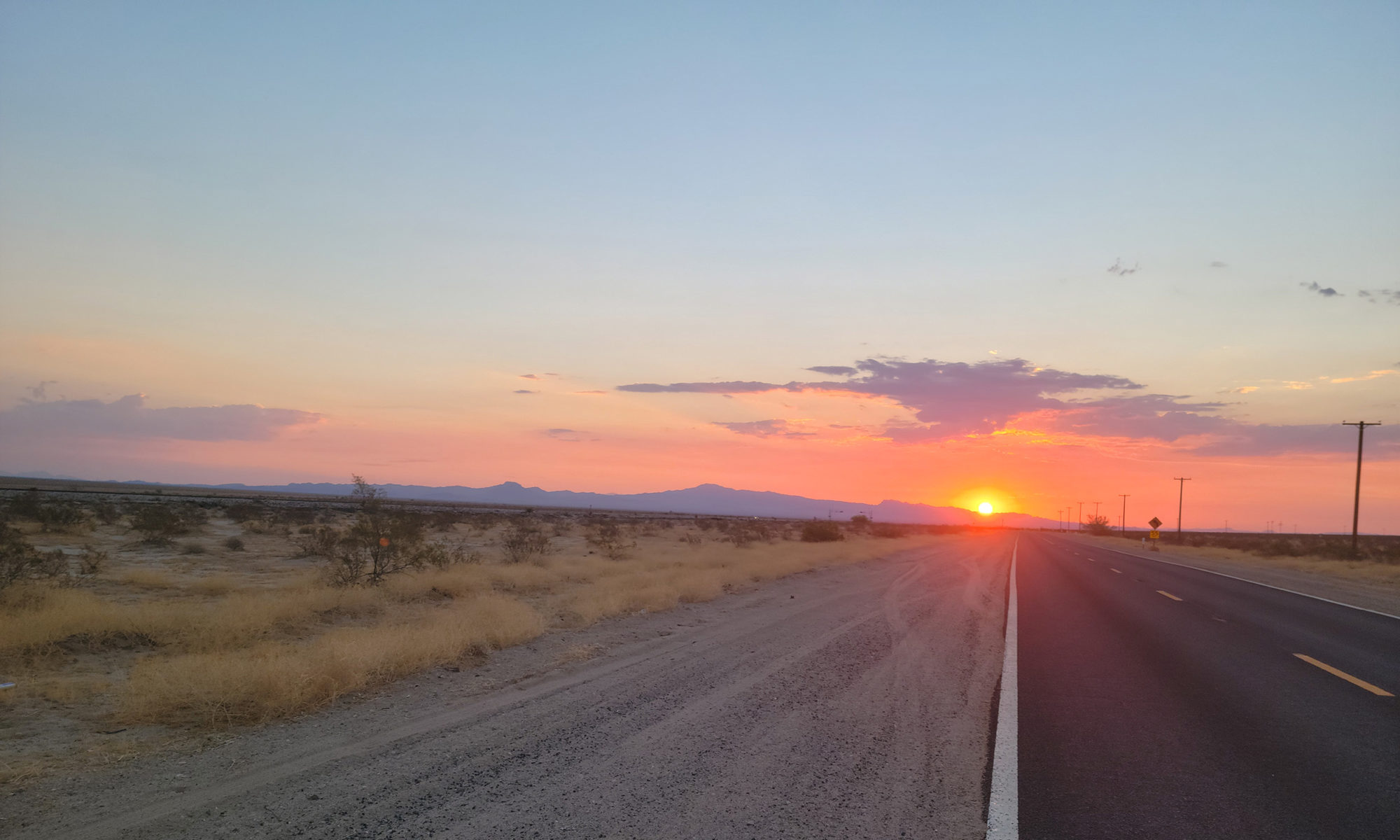
But for the moment, walk I did, continuing on my way. Past Pancho’s. Across the obnoxious, unwalkable highway (after waiting eight minutes for a break in traffic). I could feel Melissa’s prying eyes still upon me as I walked back onto the AT.

Was it true? Had I escaped Daleville?

Gone But Not Escaped

But of course, it was all a ruse. Even as I lost sight of the Super 8 for the moment, I could hear that incessant Daleville traffic. Would it ever cease its torment?

After more than two miles hiking, Daleville Super 8 remains in view.

I hiked for a full hour, climbing up, away, hope building with every step, every foot of elevation gained. I crested a mountaintop adorned with massive, humming power lines.

That’s when I fell to my knees in agony. Of course it was all too good to be true. I would never escape Daleville. For far below, even after hiking for two hours, lay an unobscured view of the town, splayed in all its mundane paleness. And directly across from me, glaring in a clearing, its neon sign reaching out to me miles away, pulling me back: the Super 8.

I hadn’t escaped anything. I hastened onward, still determined to leave Daleville behind for good. Another hour, another several miles along a mountain ridge. Still, relentlessly as I stopped for breath, the traffic and sounds of Daleville and that loud yellow sign yelling Super 8 reaching up to me in the hills.

I was convinced. I could hike all day, for days on end even, and still not escape this bland, nondescript town and the Super 8 that once offered succor.

If you squint, you can still see Daleville Super 8’s yellow sign far in the distance.

Even now, alone in the woods, night setting in, while I can no longer see Daleville below, nor hear its car horns honking, its truck engines whining, while the Super 8 sign doesn’t light up the forest, I know. It’s still there. Never far away. Beckoning me back. It will always be there. When I close my eyes. When in the silence I hear its echoes. Whenever I dine out on mediocre Mexican food.

I’ve left Daleville, but I haven’t really escaped. I will go back again someday.

I am, after all, as Melissa made all too clear, a regular at the Super 8.   

Shifting Credibility as a SOBO AT Thru-hiker

As an Appalachian Trail thru-hiker, once you’ve trekked southbound through Maine’s gnarly trails and into New Hampshire’s White Mountains, attitudes and perspectives change dramatically.

You gain a new kind of street (or, in this case, trail) cred. Fellow thru-hikers look at you differently, talk to you with a heightened respect and seek your knowledge in a way they never would have when you were a newbie back in central Maine.

View of Mount Washington in the clouds, from summit of Mount Pierce.

In those nascent days of first stepping into the 100-mile wilderness, the few northern-bound thru-hikers (NOBOs) floated by like battle-worn soldiers, having survived the Whites and the maddening, rocky, rooty climbs of southern Maine – not to mention 1,700 previous miles of AT. You nearly genuflected to their experience and superior knowledge, like a rookie thirsting for nuggets of wisdom.

I was talking about this with my hiking friend Grills on a recent descent down from the Franconia Ridge. Grills completed thru-hikes of the Pacific Crest Trail (PCT) and the Continental Divide Trail (CDT) and has hiked the Colorado Trail, the Arizona Trail and other rites of passage. His successful completion of an AT thru-hike will net him the vaunted Triple Crown, a rare accomplishment of having thru-hiked the AT, PCT and CDT. These people are regarded like hiking gods on the trail.

“It’s like everything changes once you get into the Whites as a SOBO,” Grills said. “Like all of a sudden you got respect.”

I had to agree, and said so. “I’ve noticed,” I said. “Now, NOBOs ask me for advice about the trail coming up and listen to what I have to say. It wasn’t like that in Maine.”

100-Mile Test

There’s no name for this phenomenon that I know of. It’s just a shift, a subtle accumulation of worldliness by virtue of having gone through something difficult and survived to continue on.

This is an earned respect, to be sure. Hiking the AT south through Maine is, by popular consent, a trial by fire, a grueling 280-mile test of will in which your body and mind will be pushed to their limits of ability, resourcefulness, patience and endurance.

On my first day heading into the 100-mile wildnerness, back on July 1, I stopped by a convenience store at Abol Bridge, the northbound entrance to Baxter State Park, to chat with a few fellow hikers. One 19-year-old NOBO was giving us SOBO newbies an account of what lies ahead.

“The 100-mile wilderness is a test to make sure you can even survive out here,” he explained. “Then you make it through there, and you climb up White Cap Mountain, your first ‘real’ mountain. That’s a warm-up for what’s coming up in southern Maine. And that’s a warm-up for the Whites in New Hampshire. It just keeps getting harder and harder, man.”

With each word me and my fellow SOBOs slunk deeper, our chins lowering heavily to the ground, daunted by his admonition. What were we getting ourselves into?

Earned Respect

That young NOBOs words turned out to be punishingly precise, and rang in my head every time I pushed my body to take another steep step upward climbing through the mountains of southern Maine and New Hampshire’s Whites.

Now, on the other side of the White Mountains, about to walk across the Connecticut River from Hanover, New Hampshire, into Norwich, Vermont, I understand with a rearview lens what all the admonitions were about.

Main intersection, downtown Hanover, NH

Hiking the AT SOBO will require grit right up front before your body and mind realize the need for it. The way I see it in retrospect is that I went into a kind of shock in which my brain became hyper-focused on the task – i.e. making it through Maine, surviving the seemingly impossible climbs of the Whites.

Once you do – once you survive that rite of passage and come out on the other side, that is, here in Hanover, NH – you have earned a certain aura of hard-earned respect based on your experience. NOBOs have not yet gone through this grinder, though they have survived the long-term slog to get this far north on the trail.

But at this trail transition, from the straight-up climbs, rocks and roots of Maine and New Hampshire, to the relatively smoother, dirt and pine-needle trails with vastly milder inclines of Vermont, Massachusetts, Connecticut and New York, we SOBOs and our northern counterparts are clearly on more even ground. The mere whiff of superiority from those NOBOs of Maine doesn’t exist here. We are closer to brethren, mutually respecting what each other has achieved.

And we’re still here, continuing on.

Just Let Maine Have Its Way

Maine is going to win. Of that you can be sure.

Hiking the Appalachian Trail in Maine is a matter of submission. When and how long it takes are the only questions.

Summit of Katahdin: the beginning of a southbound AT thru-hike.

I began my thru-hike of the Appalachian Trail with a summit of magnificent Mount Katahdin on June 30. I opted to take the Knife Edge trail to the summit, where the northern terminus of the AT begins. The Hunt Trail down Katahdin is also the AT, and thus began my thru-hike all the way to Georgia.

Following the Katahdin summit, a southbound AT thru-hiker (known as a “sobo”) then heads south through Baxter Park to Abol Bridge, the south park entrance, and the official beginning of the 100-mile wilderness. This is a trail stretch known for its isolation, lack of towns or amenities, comforts and exit routes. It’s just wilderness.

What the 100-mile wilderness also offers are breathtaking vistas, countless water bodies, no limits on serenity, peace and nature.

Hiking in Maine

I began my thru-hike into the 100-mile wilderness with the arrogant thought that I’d done a lot of hiking over the years, pretty much knew what it was about and would be the controller of my hiking destiny. That worked for a couple days. I had outlined a hiking schedule in advance, knowing it would be a flexible plan.

If you look closely, you can see a trail under all those roots.

What I learned fairly quickly is: hiking in Maine isn’t like hiking in most other places. Hiking in Maine is rugged, gnarly and slow. The environs are spectacular, but Maine’s trails feature massive, boa constrictor-sized roots that snarl up to snag your ankles and trip you at every opportunity. And not just every once in a while; constantly, and bunched together relentlessly. And in the few areas where there are not roots, there are rocks. Not evenly sized rocks, but all different sizes, cluttering the trail haphazardly so you can never take two steps the same, you’re always varying your speed, step and pace.

It’s always either roots or rocks. And that’s the easy part of hiking in Maine. That’s before the mountain climbing starts, heading south. Then it becomes all of the above except now you’re ascending a steep (no switchbacks in Maine) slope for two thousand vertical feet.

Who’s in Charge?

After a few days of pushing along imagining that I would cruise through Maine according to my schedule, insisting that I was in charge of my own hike, I soon learned that that was not the case.

I wasn’t in charge. I’m not in charge. Maine is in charge.

Spectacular summit of Saddleback Mountain

As soon as I relented, slowed down and agreed that I was subject to Maine, not the other way around, I began to enjoy its trails more.

Maine sets the rules, not you as hiker. Maine tells you when you will be able to cruise along for a few miles, when you will get tired, and when you must go very slow.

The sooner you realize that on this state’s trails, the more you will enjoy the experience.

Just let Maine have its way.

Praise to Maine

I’m relieved I gave in to Maine and recognized its natural dominion over me. Thankful I genuflected early on to its obvious authority and relaxed into it.

Hammock camping next to Little Jo Mary Lake, a highlight of the 100-mile wilderness.

Now, as my unwritten pact states, I accept what Maine agrees to grant me. I appreciate the precious few moments when the hiking is smooth. I slow way down to a single mile an hour on numerous occasions, to get up tall, unforgiving mountains, to pick my way intentionally through the maze of tree roots and sharp rocks strewn across the path. I respect the dangers of being hasty and trying to move through this state too quickly. That’s a recipe for injury.

Maine has been one of the hardest places I’ve hiked. In a way, I look forward to working my way beyond this state. In other ways, I will miss it.

Anyway, it’s not like getting through Maine offers any great reward heading southbound on the AT. Next up: New Hampshire’s White Mountains.

That should be much easier.

What Have We Done Lately?

Getting Way Out There While Winter Hiking in the Whites

New Hampshire’s White Mountains are among the most formidable hiking proving grounds in the eastern United States. Renowned for its 48 4,000-foot peaks, the White Mountains present challenges for hikers at every level.

Winter hiking in the Whites presents its own special challenges, and until this past month I had never tried it. I drove up toward Twin Mountain, NH, from where I would set out, on December 27, curious about the experience. I had two days of solo hiking in front of me.

Summit of Mount Pierce, New Hampshire White Mountains
Mount Pierce summit

I chose to hike up Mount Pierce on the first day, with an option to loop over to Mount Jackson, two 4,000-foot peaks in the famous Presidential Range, of which Mount Washington is part. I harbor an aspiration to winter hike up Mount Washington at some point, and I’d read that Mt. Pierce was one of a few good warmups for that much larger, and more dangerous, undertaking. (I will be writing about that adventure when I succeed!)

More Challenge Needed

Starting from the Highland Visitors Center on Route 302, I headed up the Crawford Notch Trail. This is not a difficult trail as they go in the Whites. It climbs steadily for about 3.2 miles, not especially steep. This moderate climb attracted a good share of hikers that day, so that the snow was well tamped down and the footing reliable. It was a cloudy day so views from the top were nonexistent around mid-day. What the peak of Pierce did offer was a harsh, snappy wind and a bald top that deterred lingering for very long there.

I sought more. So from the summit of Pierce I proceeded on the Mizpah Trail. As fellow hikers returned, doubling back on the same trail down, I trudged forward into the back woods on a little used trail with the snow path barely broken. For more than two hours I pushed through deep snow not seeing anyone else. It was isolated, still and utterly beautiful, with a modicum of risk (if anything happened to me out here, no one was coming to help.)

Exactly what I was looking for. Silence, solitude, snow and a decent challenge. I came across Mizpah hut, a good-sized lodging hut open to hikers starting in late spring all the way into November. My daughter, Livvy, was hut master at Mizpah this past fall, so I stopped and snapped some pictures of the boarded-up building to share with her.

Mizpah Hut, White Mountains
Mizpah Hut

Then I proceeded onto Mt. Jackson, still not seeing anyone for hours. I was in heaven. As I climbed to the summit of Mount Jackson, the wind whipped up and the skies cleared to give me an extended, stupendous view of the Presidential Range and beyond. It was blustery and cold so I didn’t stay long. But in the wind the trail down was hard to locate and for a minute I searched, haunted by numerous stories of hikers getting disoriented in the Whites and stumbling off the trail and getting in trouble.

Mount Jackson summit

Finally I found the Jackson Bridge Trail, which slipped straight down through an iced over and very slick rock gap. Really? I thought as I perused the gap from above. I’m supposed to go down that? I took my time and made it, then trudged the three miles descent back to the Highland Center.

More Deep Snowing Hiking

The next day I decided I would bag a couple more 4,000-footers, toying with the idea of adding all 48 4,000-footers in the Whites to my adventure list. It’s a thing. I’ve climbed about a dozen of them so far. We’ll see.

For today it would be the Kinsmans, north and south, two peaks on the north side of Route 93, opposite Franconia Ridge, which I’ve already done (though not in winter, when it becomes a more formidable endeavor).

I started up the Lonesome Lake Trail, another well-trodden path with no shortage of fellow hikers. About a half-mile up, I spotted an interesting but difficult-looking trail jutting straight up. I checked my map: the Dodge Cutoff, which led to the Kinsman Ridge Trail. I knew nothing about these, but it was off the beaten path so I took it.

A brilliant view of Franconia Ridge from Kinsman Ridge Trail

It was all I could handle. The Dodge Cutoff climbed straight up (no switchbacks in the Whites) and it wasn’t well-traveled so I was pushing through deep snow. I opted to continue climbing to Kinsman Ridge Trail, a gorgeous back country trail that cuts through the alpine at around 3,700 feet, just below Cannon Mountain.

I wanted isolated wilderness and I got it on this trail. It took me nearly three hours –no other hikers around – of steep ups and downs to work my way back to the more populated Lonesome Lake Trail. By then it was after 2 p.m.

More Adventures in the Whites

I opted to bail on the Kinsmans for the day. It would have been another two miles of climbing. I was zonked from the outback rugged trail I’d taken, plus the deep snow. Also, I would have run out of daylight, and though I had a headlamp, I didn’t want to be hiking down in the dark. I also had a three-hour drive back home when I was done.

The down via the Lonesome Lake Trail was steep and fast. I made it back to my car before 4 p.m. Almost six hours of steady hiking. I was ready to head home.

The beautiful thing about the Whites is that the park is so vast and there are so many trails that a hiker can get whatever they are looking for. A communal nature experience. A range of exertion levels, from moderate to difficult to intense. Or, pure isolation, in which some of the trails lead you deep into the wilderness where few others tend to go.  

That’s what I was seeking for this adventure. That’s what I got.

Many more White Mountain trails to explore.

All for 15 Minutes Atop Mt. Greylock

Bike to Mt. Greylock summit, Massachusetts

Ride: Easthampton to Mt. Greylock summit, RT
123 miles, 9,000 feet climbed

Some goals aren’t about the goal. Some goals are about everything surrounding the goal: the planning, the anticipation, the work, time and travel spent achieving the goal, and the return from that achievement.

Cycling from my home in Easthampton to and up Mt. Greylock, the highest point in Massachusetts at 3,500 feet, was an all-day endeavor. It’s about a 50-mile ride just to get to the base of the mountain on the southern side, and that’s if you don’t take any wrong turns or waste valuable time blindly following your nav’s direction into a rabbit hole of mountain bike trails for which you’re not equipped.

As it is, riding from Easthampton to the Greylock base in Lanesboro is 3,700 feet of climbing up out of the Valley. Your mph isn’t going to be optimal even without the mountain bike trails.

I headed out my driveway at about 7:20 a.m. The day was perfect, about 60 degrees to start, a few clouds and clearing up. I made good time, as one may, to Williamsburg. Then the climbing started, up Route 9, five miles uphill to Goshen. From there, up and down to Cummington and a requisite stop at the Olde Creamery. Four miles beyond the Creamery, my nav suggested getting off Route 9 onto Main Road in West Cummington. I was eager to try an unfamiliar route, so I followed as the roads began climbing steeply, then narrowed, then turned to gravel, then dirt. Finally, I found myself on a single-track muddy suggestion of a path littered with bowling ball-sized rocks and stream crossings testing both my riding ability and my gravel bike’s endurance. My bike, True, who, after all, recently took me across America, was plenty tough enough. It’s just that, I was spending a lot of time and energy traversing this mountain bike trail, and I wasn’t close to Mt. Greylock.

When I finally found my way off the mountain bike trail, nav again suggested a turn and I took it, eager to get back on track. I rode a mile in and the road, now gravel, abruptly ended. There may have been a path there through the woods, back sometime in the 1960s? But little sign of anything trail-like now. So I begrudgingly turned around and headed back to the main road, cussing the entire way.

I came to Route 116 and realized it would take me to Adams and toward the north side of Greylock, not where I wanted to be. (The north road up Greylock is much more difficult than Rockwell Road on the south side.) So I opted to add about eight miles to the route, and take the time to head back down through Cheshire and work my way over to the south base of the mountain. Again, gravel roads, and my phone carrier now loosening up so that my phone fell out onto the road at one point.

Was I suspecting at this point that my Greylock trip was in jeopardy? Yes. Did I consider for a few minutes bagging the entire goal and trying another day? Yes. Sometimes it’s the smart move. Unfortunately, I too often ignore such omens and push through, which I did.

By the time I got to the Greylock Visitors Center on Rockwell Road, I’d ridden 63 miles and climbed more than 3,700 feet. The summit, my goal, was still eight more miles away and 1,700 feet uphill. After a break and a snack, I started up the steep road.

Reaching the summit of Greylock was a spectacular triumph. The weather was about as good as it gets and the views were/are stunning.

For 15 minutes. Ironically, I determined that the climbing of Greylock wasn’t as difficult as the ride to get there.

I’d have gladly spent longer up on Greylock, but because I’d taken wrong turns and pretended I was a mountain biker on the trip there, I’d lost too much time to dally at the top. I still had 60 miles to ride back home. And anyway, I’ve been atop Greylock many times, and will be many more.

The ride home was 1) grueling, 2) long, 3) a rush in places, and finally, 4) a relief. In brief, the climb out of Pittsfield up to Windsor on Route 9 was brutal. My back was killing me as I plodded along literally in my lowest climbing gear. Again, climbing up from Cummington to Goshen, hard and slow.

But once I reached Goshen, I knew I was golden with about 22 miles to go. I turned on the speed, 5 miles back downhill, Goshen to Williamsburg in 10 minutes, 30 mph all the way and loving every second. Then an easy jaunt on the bike path all the way home from Haydenville back to Easthampton. I rolled in at 6:45 p.m., dusk setting in.

This was a goal on my list since last spring, a big one. I set my personal records for one-day mileage and climbing. As I relaxed later that night, I couldn’t help thinking ahead to more, bigger goals. Could I make it from Easthampton to Burlington, VT, in one day?

August Adventure Month: Day 22

Mt. Marcy summit, Adirondacks, New York

I declared August 2021 Adventure-a-Day Month (yes, I can do that)! Every day of August, I embarked on some type of adventure, 31 days, 31 adventures, some big, some small, some physical, some mental. It’s my way of making adventure part of everyday life. I write about each adventure below.

Day 22: Sunday, August 22
Climbing Mt. Marcy, NY (high point)

I love the Adirondacks. Mt. Marcy, just outside of Lake Placid, NY, is the state’s highest point at 5,300 feet, so I was able to add another to my ongoing endeavor of standing on the highest point in all 50 U.S. states. This climb is long and meandering, gradually up through woods for more than six miles before an intense rock climb for the last mile to the summit. Then the trees clear and you get this incredible view of mountains stretching in all directions. I heard the crowds swell atop Mt. Marcy, but on this day (as Hurricane Ida thrashed Connecticut and other lower regions) the crowd was minimal. Another high point climbed, this was a good one. And I couldn’t resist getting a shot of these gorgeous wildflowers near the top.

Adventure: Climbing Mt. Marcy, NY.
Distance traveled: About 16 miles hiking RT.
Challenges: Enduring a long hike, scrambling up rocks, rationing water and food because I didn’t pack enough!
Risks: Slipping and falling, turning/spraining an ankle, dehydration.
Difficulty scale 1-10: 7
Highlights: An awesome view and lovely winds atop Mt. Marcy. Great payoff for the long hike getting there.